Yankton County Emergency Management
There's no harm in hoping for the best as long as you're prepared for the worst
Yankton County Open Burning Permited

There's no harm in hoping for the best as long as you're prepared for the worst
Yankton County Open Burning Permited


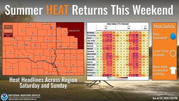
7-24-2026

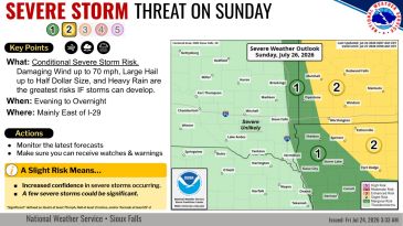
7-25-2026
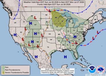
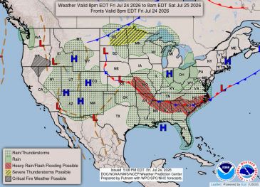
7-26-2026

Bridge Closure – Yankton County Highway Department has announced the closure of the Stone Church Bridge on 431st Ave over the James River. Construction will begin on January 20th at 7 am. The bridge will be closed until sometime in 2027. This is a total bridge replacement over the James River. Use Designates detour routes to get around this construction site. More information will become available as time goes on. got to the Yankton County website, Yankton OEM website, or Facebook page, and Yankton County Highway Facebook page,
